Categories
International S&T News

National Aerospace Industry Towards Golden Indonesia 2045

The National Development Planning Agency (Bappenas) has launched a roadmap for the development of the national aerospace industry with the vision: “A Resilient and Competitive Aerospace Industry Towards Golden Indonesia 2045.” One of the four pillars of the aerospace industry ecosystem is the development of the aircraft manufacturing industry, with three main targets: producing turboprop aircraft with a capacity of fewer than 100 passengers, manufacturing unmanned aerial vehicles (UAVs) for cargo transportation, and becoming a leading producer of flight simulators.

According to the Bappenas roadmap, the mission in developing the aircraft manufacturing industry is: “Strengthening the aircraft industry, components, and aerospace supply chain.” The next step is to implement the National Aerospace Industry Development Roadmap, which was launched in 2023.

A Resilient and Competitive Aerospace Industry Towards Golden Indonesia 2045
doc PT Dirgantara Indonesia

The Center for Technology & Innovation Studies (CTIS) recently organized a discussion on the development of Indonesia’s aerospace industry, featuring Ir. Agung Nugroho, a former aircraft designer at PT Dirgantara Indonesia and currently the founder and CEO of PT Aviasi Indonesia Maju. The discussion was moderated by Professor Anton Adibroto, Chairman-I of CTIS and a Professor of Aerospace Engineering at the University of Malaysia – Kelantan (UMK).

Agung Nugroho began his presentation by outlining the history of Indonesia’s aviation industry since the country’s independence. He highlighted how, at that time, technicians from the People’s Security Army – Air Force (TKR – Udara) successfully repaired and flew former Japanese Air Force aircraft. Notably, on July 29, 1947, Indonesia successfully conducted an aerial bombing operation targeting Semarang, Ambarawa, and Salatiga.

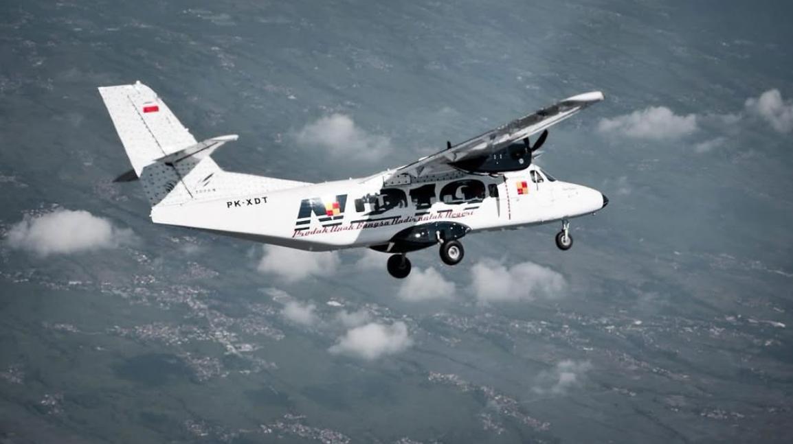
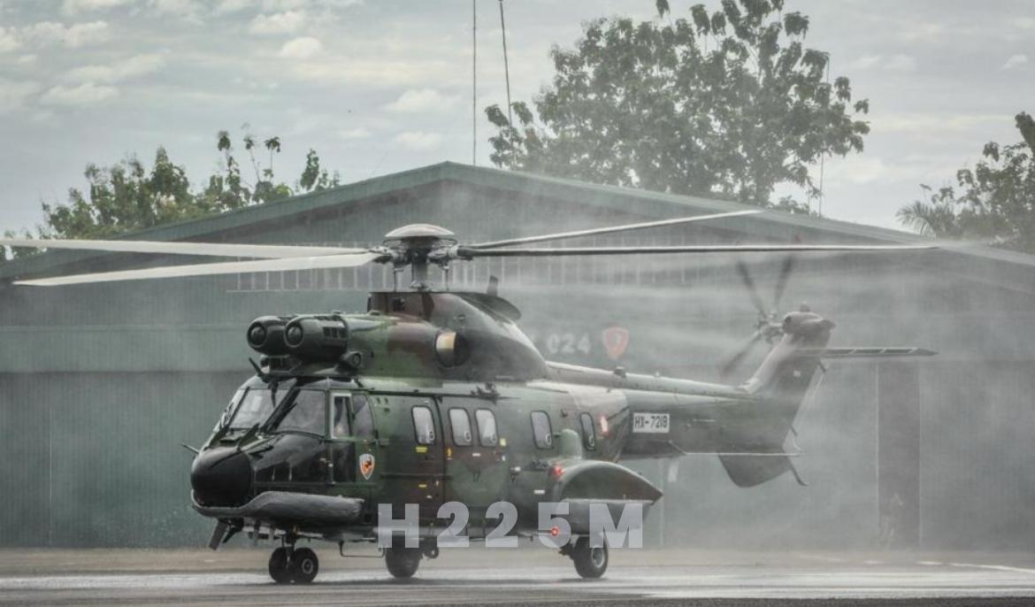
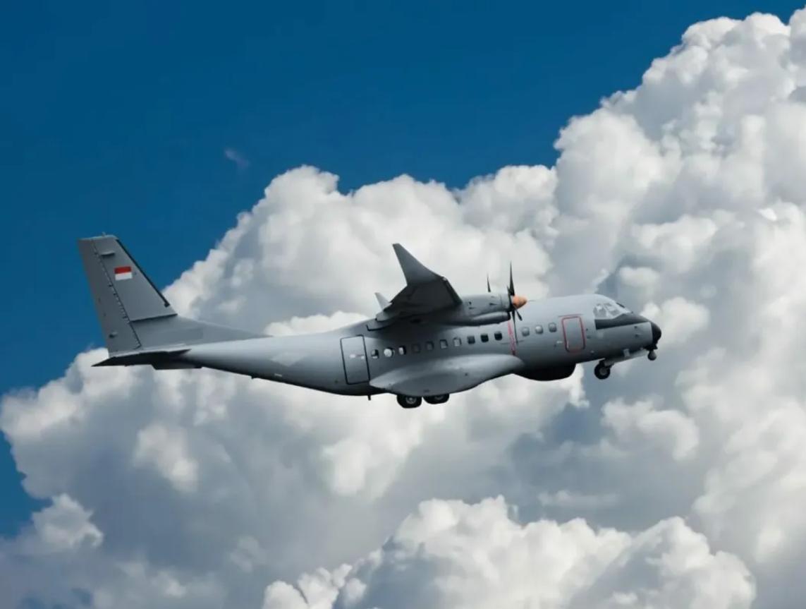
By 1950, aircraft repair and testing operations were moved to Andir Air Base in Bandung. Subsequently, the Bandung Institute of Technology (ITB) established its Aeronautical Engineering Department in 1960. In the 1970s, the Nurtanio Aviation Industry Institute (LIPNUR) was founded at Andir Air Base, later renamed Husein Sastranegara Air Base. This marked the beginning of modern aircraft manufacturing in Indonesia with the establishment of PT Industri Pesawat Terbang Nurtanio (IPTN), which produced aircraft such as NC-212, CN-235, N-250, C-295, and assembled helicopters like NBO-105, AS-332 Super Puma, Bell-412, and Cougar, in collaboration with France.

doc PT Dirgantara Indonesia

Agung Nugroho explained that despite domestic political challenges, PT IPTN, later renamed PT Dirgantara Indonesia (PT DI), continued to innovate by developing the N-219 “Nurtanio” aircraft and manufacturing components for the F-16 fighter jet ordered by General Dynamics (USA) and Airbus (France).

As the world’s largest archipelagic country, Indonesia must have a strong aircraft and shipbuilding industry to support inter-island transportation. Data from the International Air Transport Association (IATA) projects that by 2036, Indonesia will rank 4th globally in aircraft demand, following China, the United States, and India.

Agung emphasized that Indonesia’s aerospace industry development from 1970 to 2000 provides a solid foundation for future growth. The country already possesses expertise in design, development, system integration, and aircraft certification. The key challenge now is to continue national strategic aircraft programs, optimize existing industrial infrastructure, and enhance capabilities continuously—starting with fulfilling domestic demand before entering the international market.

Additionally, research, innovation, and human resource development must be accelerated to support aerospace industry growth. Agung also highlighted the importance of government commitment and national leadership in fostering a sustainable aerospace industry ecosystem. He concluded by mentioning that the soon-to-be-established financial institution Danantara will provide a much-needed boost for long-term strategic industries in Indonesia, particularly in aircraft manufacturing.


source: https://environews.asia/national-aerospace-industry-towards-golden-indonesia-2045/

Categories
International S&T News

Indonesia in Managing Potential Conflict Areas into Zones of Cooperation

The Latin phrase “Si vis pacem, para bellum” means “If you want peace, prepare for war.” Its implementation for a maritime nation includes having strength for naval defense, maritime security, and safety, as well as carrying out various societal activities at sea. As the world’s largest archipelagic country, Indonesia must internalize and uphold this principle. This was the conclusion of the Center for Technology & Innovation Studies (CTIS) discussion on Wednesday, February 5, 2025. Speaking at the discussion, which took the theme “Geo-Maritime Dynamics of the Indo-Pacific Region: Indonesia in Managing Potential Conflict Areas into Zones of Cooperation,” was Admiral (Ret.) Prof. Dr. Marsetio, a professor at the Indonesian Defense University and Chief of Staff of the Indonesian Navy from 2012 to 2014. The session was moderated by Dr. Nadirah, Deputy Secretary-General of CTIS and an environmental expert from BRIN.

Indonesia belajar dari konflik Sipadan dan Ligitan agar tidak diklaim pihak asing

Prof. Marsetio began his presentation by discussing Indonesia as the world’s largest archipelagic state, recognized under the United Nations Convention on the Law of the Sea 1982 (UNCLOS ’82), which has been ratified by 168 countries. In UNCLOS ‘82, it is stated that Indonesia’s territorial sea extends 12 miles from the outermost points of its outermost islands, known as baseline points. These baseline points are connected to form a baseline, determining Indonesia’s territorial sea sovereignty, covering 3.1 million square kilometers. Within this maritime area, Indonesia has the right to raise its national flag, the Red and White.

Additionally, Indonesia’s Exclusive Economic Zone (EEZ) extends 200 miles from the coastline, covering an area of 2.7 million square kilometers. Within the EEZ, Indonesia does not have full sovereignty over the waters, but all economic resources above the water, within the water, on the seabed, and beneath the seabed belong to Indonesia. Furthermore, if Indonesia can scientifically prove that its sedimentary rock layer extends up to 350 miles from the coast, the area, known as the continental shelf, along with its potential resources—mainly minerals and oil & gas—also belongs to Indonesia.

Naturally, Indonesia’s vast maritime territory of 5.8 million square kilometers must be safeguarded, secured, and its resources optimally utilized for the prosperity of the Indonesian people. This is particularly critical in the North Natuna Sea, which is rich in fish and has significant oil and gas potential but is frequently entered by foreign fishing vessels from Vietnam and China. Ironically, both of these countries have also ratified UNCLOS ’82.

Marsetio emphasized that one of the world’s major maritime conflict zones could arise in the South China Sea. Historically, the United States Navy has had dominant influence in the Pacific Ocean and the South China Sea, but this presence is now being challenged by China’s growing naval power. Furthermore, warships from NATO member countries such as Italy and France have begun patrolling the South China Sea, with their movements being closely monitored by the Chinese Navy and the China Coast Guard. Even a minor friction or provocation could ignite conflict in these waters.

Indonesia’s Exclusive Economic Zone (EEZ) extends 200 miles from the coastline, covering an area of 2.7 million square kilometers.
Sipadan and Ligitan islands. (dok app.goo.gl)

Adding to the tensions, Chinese fishing vessels have frequently intruded into Indonesia’s EEZ. Marsetio stressed that Indonesia must maintain a strong presence in the North Natuna Sea—both in terms of defense and security forces, conducting marine research, and ensuring that Indonesian fishers operate there in significant numbers. If the number of Indonesian fishing vessels and fishers is lower than that of foreign fishers, history could repeat itself—similar to the loss of Sipadan and Ligitan Islands in 2002.

When the territorial dispute over Sipadan and Ligitan Islands was brought to the International Court of Justice (ICJ) in The Hague, Netherlands, the judges posed a critical question: “Who has been maintaining, developing, managing, and actively engaging in activities on Sipadan and Ligitan?” The answer was “Malaysia.” As a result, the ICJ ruled in favor of Malaysia. This loss occurred because Indonesia had never actively engaged in or managed these islands.

Professor Marsetio, who frequently represents Indonesia at International Maritime Organization (IMO) meetings, proposed a cooperative approach to utilizing Indonesia’s EEZ—both with domestic and international partners.

As an initial step, Marsetio, who currently serves as an advisor to the Minister of Higher Education, Science, and Technology, announced that a research expedition in the North Natuna Sea will soon be conducted. This will involve the Indonesian Navy’s Hydro-Oceanographic Survey Vessel and invite Indonesian marine scientists, with research funding provided by the Indonesia Endowment Fund for Education (LPDP). Beyond gathering marine data and research findings, the presence of the Indonesian Navy’s survey vessel will further assert Indonesia’s sovereignty over the North Natuna Sea.

For international collaboration, Professor Marsetio cited specific provisions in UNCLOS ’82 as the legal framework, particularly Article 62, which states that marine resources—especially fisheries—within an EEZ belong to the coastal state. If the coastal state is unable to fully exploit these resources, it can cooperate with other countries for joint resource utilization. For Indonesia, as a coastal state, entering into fair and transparent agreements with foreign partners to utilize its marine resources—such as tuna fisheries—could be a viable strategy.

Through these various initiatives and under the legal umbrella of UNCLOS ’82, numerous cooperative approaches can be adopted instead of resorting to conflict.

“The most important thing is ensuring that we are always present in our own waters,” Admiral (Ret.) Prof. Dr. Marsetio concluded.

source: https://environews.asia/indonesia-in-managing-potential-conflict-areas-into-zones-of-cooperation/

Categories
Domestic S&T News

Kondisi Geografis Ideal, Indonesia Butuh Kebijakan Keantariksaan dan Peta Jalan Industri Persatelitan

Hampir setengah abad Indonesia menerapkan teknologi komunikasi satelit domestik. Dimulai saat Satelit Palapa A meruangangkasa pada tahun 1976 yang menempatkan Indonesia sebagai negara ketiga di Dunia yang menerapkan Sistem Komunikasi Satelit Domestik (SKSD) sesudah Amerika Serikat dan Kanada.

Sebagai negara kepulauan terbesar di dunia dengan panjang 5100 kilometer di katulistiwa, tidak mungkin negara sebesar ini hidup tanpa teknologi satelit, baik itu satelit komunikasi, satelit remote sensing maupun satelit navigasi.

Dengan semakin canggihnya teknologi satelit, semakin efisien pengoperasiannya dan biaya yang semakin murah, saat ini pengembangan teknologi satelit sudah bukan hanya domain Pemerintah saja, namun peran industri satelit swasta juga sudah bermunculan di tanah air, baik untuk ruas antariksanya maupun untuk ruas Buminya.

Namun, masih ditunggu adanya kebijakan Nasional tentang Keantariksaan dan Peta Jalan pengembangan Industri Satelit di tanah air agar potensi penerapan teknologi antariksa semakin optimal dengan investasi kemampuan sumber daya manusia yang semakin mumpuni.

Demikian ringkasan hasil pertemuan Center for Technology and Innovation Studies (CTIS) di Jakarta, Rabu, 12 Juli 2023.

Indonesia membutuhkan peta jalan keantariksaan nasional.

Diskusi CTIS menampilkan Ir. Adi Adiwoso,  Direktur Utama PT. Pasifik Satelit Nusantara (PSN), yang juga salah seorang perintis pembangunan satelit Palapa A-1 lebih 48 tahun lalu bersama tokoh persatelitan Indonesia, Alm. Profesor Iskandar Alisyahbana.

PSN baru saja berhasil meluncurkan Satelit Satria-1, pada 18 Juni 2023 dari Tanjung Canaveral, Florida AS, dan mulai akhir 2023 nanti akan melayani 50.000 titik jaringan internet diseluruh Indonesia.

Investasi swasta yang dibenamkan untuk pembangunan Satelit Satria-1 mencapai Rp8,1 triliun, yang nantinya akan disewa oleh Pemerintah untuk melayani daerah daerah terluar, tertinggal, dan terdepan Indonesia.

Adi Adiwoso menyampaikan bahwa setelah memetik pengalaman hampir 50 tahun, investasi swasta di bidang persatelitan di Indonesia sudah semakin layak.

Satelit swasta pertama di Indonesia adalah Satelit Cakrawarta-1 yang meluncur tahun 1997.

PSN sendiri mulai meluncurkan satelit komunikasi Garuda-1 pada tahun 2000. Saat ini PSN mengoperasikan Satelit Nusantara-1 sebagai satelit Broadband Pertama di Indonesia dan tengah bersiap meluncurkan Satelit Nusantara-5.

Di samping itu, ahli-ahli Indonesia juga sudah mulai membangun satelit satelit mini secara mandiri, yang dikenal sebagai Cubesat untuk ditempatkan di orbit rendah (Low Earth Orbit – LEO) ketinggian 500 kilometer.

Contohnya LAPAN-IPBSat untuk pertanian dan konservasi lingkungan (2013), LAPAN-A3Sat untuk remote sensing dan cuaca, ITB-Sat buatan ITB-Bandung, dan UNIBRAW Sat buatan Universitas Brawijaya Malang.

Kesemuanya ini dimungkinkan karena telah tersedianya teknologi 4.0,  termasuk teknologi Internet of  Things (IOT),  juga 3-D Printing yang memungkinkan rancang-bangun satelit dapat dilaksanakan secara cepat dan rinci.

Indonesia sukses meluncurkan satelit ke-18-nya, BRISat, di Guyana Space Center, Guyana, Prancis, pada Sabtu, 18 Juni 2016. (dok Komdigi)

Ditambah lagi, teknologi peluncur roket yang sudah sangat tersedia dengan biaya yang semakin murah.  Sebagai perbandingan, saat ini tengah dibangun jaringan satelit Starlinks yang terdiri 4000 satelit internet yang melingkupi seluruh Bumi, sehingga fasilitas internet dapat dinikmati oleh seluruh penduduk Bumi.  Untuk itu, diluncurkan 60 satelit Starlinks per-minggu menggunakan roket Falcon-9 yang komponen-komponen roketnya dapat digunakan kembali (reusable), membuat operasi peluncuran roket cukup memakan biaya 10 juta dolar AS saja.

Adi Adiwoso juga menyampaikan bahwa satelit satelit komunikasi, seperti Satelit Satria-1, juga dilengkapi sensor cuaca sehingga bisa berfungsi sebagai satelit cuaca, mengingat operasi satelit komunikasi juga berkaitan dengan kondisi cuaca, liputan awan dan kelembaban wilayah yang dicakup satelit.

Di samping itu, jaringan satelit komunikasi ini juga bisa dipakai sebagai satelit navigasi guna menentukan posisi lintang-bujur di permukaan Bumi.

Khusus untuk teknologi remote sensing, nampaknya kemampuan mengolah data remote sensing menjadi informasi, yang dianalisis guna pengambilan kebijakan, lebih penting daripada membangun satelit remote sensingnya itu sendiri.  Oleh sebab itu, aplikasi data satelit remote sensing dengan beragam perangkat lunak yang dibangun secara spesifik perlu dikuasai oleh ahli-ahli Indonesia.

Di tengah maraknya perkembangan teknologi satelit dan aplikasi teknologi antariksa di tanah air, ternyata Indonesia belum memiliki kebijakan antariksa Nasional dan juga belum ada Peta Jalan Pembangunan Teknologi Persatelitan di Tanah Air.

Misalnya, untuk pembangunan Bandar Antariksa (Spaceport) yang memanfaatkan lokasi geografis ideal Indonesia di katulistiwa untuk peluncuran roket antariksa, ternyata belum diketahui kemana perijinan dan regulasi bisa diperoleh.

Dewan Pengarah CTIS, Profesor Rahardi Ramelan, yang juga mantan Menteri Ristek/Kepala Badan Pengkajian dan Penerapan Teknologi (BPPT) menyarankan kiranya CTIS bisa mulai merintis pembuatan butir butir rancangan kebijakan keantariksaan dan peta jalan teknologi persatelitan untuk diusulkan kepada Pemerintah.

Rahardi Ramelan juga menyodorkan UU No.21 tahun 2013 Tentang Keantariksaan sebagai dasar untuk penyusunan kebijakan keantariksaan nasional. ***

sumber : https://forestinsights.id/kondisi-geografis-ideal-indonesia-butuh-kebijakan-keantariksaan-dan-peta-jalan-industri-persatelitan/