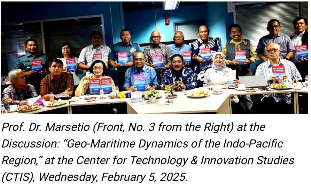
The Latin phrase “Si vis pacem, para bellum” means “If you want peace, prepare for war.” Its implementation for a maritime nation includes having strength for naval defense, maritime security, and safety, as well as carrying out various societal activities at sea. As the world’s largest archipelagic country, Indonesia must internalize and uphold this principle. This was the conclusion of the Center for Technology & Innovation Studies (CTIS) discussion on Wednesday, February 5, 2025. Speaking at the discussion, which took the theme “Geo-Maritime Dynamics of the Indo-Pacific Region: Indonesia in Managing Potential Conflict Areas into Zones of Cooperation,” was Admiral (Ret.) Prof. Dr. Marsetio, a professor at the Indonesian Defense University and Chief of Staff of the Indonesian Navy from 2012 to 2014. The session was moderated by Dr. Nadirah, Deputy Secretary-General of CTIS and an environmental expert from BRIN.
Prof. Marsetio began his presentation by discussing Indonesia as the world’s largest archipelagic state, recognized under the United Nations Convention on the Law of the Sea 1982 (UNCLOS ’82), which has been ratified by 168 countries. In UNCLOS ‘82, it is stated that Indonesia’s territorial sea extends 12 miles from the outermost points of its outermost islands, known as baseline points. These baseline points are connected to form a baseline, determining Indonesia’s territorial sea sovereignty, covering 3.1 million square kilometers. Within this maritime area, Indonesia has the right to raise its national flag, the Red and White.
Additionally, Indonesia’s Exclusive Economic Zone (EEZ) extends 200 miles from the coastline, covering an area of 2.7 million square kilometers. Within the EEZ, Indonesia does not have full sovereignty over the waters, but all economic resources above the water, within the water, on the seabed, and beneath the seabed belong to Indonesia. Furthermore, if Indonesia can scientifically prove that its sedimentary rock layer extends up to 350 miles from the coast, the area, known as the continental shelf, along with its potential resources—mainly minerals and oil & gas—also belongs to Indonesia.
Naturally, Indonesia’s vast maritime territory of 5.8 million square kilometers must be safeguarded, secured, and its resources optimally utilized for the prosperity of the Indonesian people. This is particularly critical in the North Natuna Sea, which is rich in fish and has significant oil and gas potential but is frequently entered by foreign fishing vessels from Vietnam and China. Ironically, both of these countries have also ratified UNCLOS ’82.
Marsetio emphasized that one of the world’s major maritime conflict zones could arise in the South China Sea. Historically, the United States Navy has had dominant influence in the Pacific Ocean and the South China Sea, but this presence is now being challenged by China’s growing naval power. Furthermore, warships from NATO member countries such as Italy and France have begun patrolling the South China Sea, with their movements being closely monitored by the Chinese Navy and the China Coast Guard. Even a minor friction or provocation could ignite conflict in these waters.
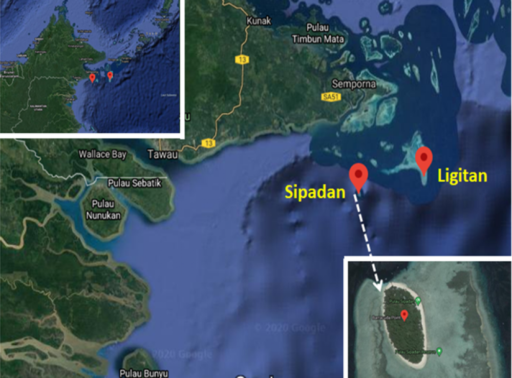
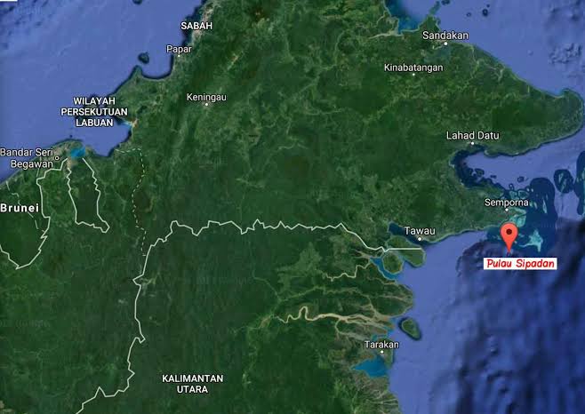
Adding to the tensions, Chinese fishing vessels have frequently intruded into Indonesia’s EEZ. Marsetio stressed that Indonesia must maintain a strong presence in the North Natuna Sea—both in terms of defense and security forces, conducting marine research, and ensuring that Indonesian fishers operate there in significant numbers. If the number of Indonesian fishing vessels and fishers is lower than that of foreign fishers, history could repeat itself—similar to the loss of Sipadan and Ligitan Islands in 2002.
When the territorial dispute over Sipadan and Ligitan Islands was brought to the International Court of Justice (ICJ) in The Hague, Netherlands, the judges posed a critical question: “Who has been maintaining, developing, managing, and actively engaging in activities on Sipadan and Ligitan?” The answer was “Malaysia.” As a result, the ICJ ruled in favor of Malaysia. This loss occurred because Indonesia had never actively engaged in or managed these islands.
Professor Marsetio, who frequently represents Indonesia at International Maritime Organization (IMO) meetings, proposed a cooperative approach to utilizing Indonesia’s EEZ—both with domestic and international partners.
As an initial step, Marsetio, who currently serves as an advisor to the Minister of Higher Education, Science, and Technology, announced that a research expedition in the North Natuna Sea will soon be conducted. This will involve the Indonesian Navy’s Hydro-Oceanographic Survey Vessel and invite Indonesian marine scientists, with research funding provided by the Indonesia Endowment Fund for Education (LPDP). Beyond gathering marine data and research findings, the presence of the Indonesian Navy’s survey vessel will further assert Indonesia’s sovereignty over the North Natuna Sea.
For international collaboration, Professor Marsetio cited specific provisions in UNCLOS ’82 as the legal framework, particularly Article 62, which states that marine resources—especially fisheries—within an EEZ belong to the coastal state. If the coastal state is unable to fully exploit these resources, it can cooperate with other countries for joint resource utilization. For Indonesia, as a coastal state, entering into fair and transparent agreements with foreign partners to utilize its marine resources—such as tuna fisheries—could be a viable strategy.
Through these various initiatives and under the legal umbrella of UNCLOS ’82, numerous cooperative approaches can be adopted instead of resorting to conflict.
“The most important thing is ensuring that we are always present in our own waters,” Admiral (Ret.) Prof. Dr. Marsetio concluded.
source: https://environews.asia/indonesia-in-managing-potential-conflict-areas-into-zones-of-cooperation/